Calculates the (planar!) azimuth between pairs in two sequences of points x and y. When point sequence length doesn't match, the shorter one is recycled.
st_azimuth(x, y)Arguments
- x
Object of class
sf,sfcorsfg, of type"POINT"- y
Object of class
sf,sfcorsfg, of type"POINT"
Value
A numeric vector, of the same length as (the longer of) x and y, with the azimuth values from x to y (in decimal degrees, ranging between 0 and 360 clockwise from north). For identical points, an azimuth of NA is returned.
Note
The function currently calculates planar azimuth, ignoring CRS information. For bearing on a sphere, given points in lon-lat, see function geosphere::bearing.
Examples
# Two points
x = st_point(c(0, 0))
y = st_point(c(1, 1))
st_azimuth(x, y)
#> [1] 45
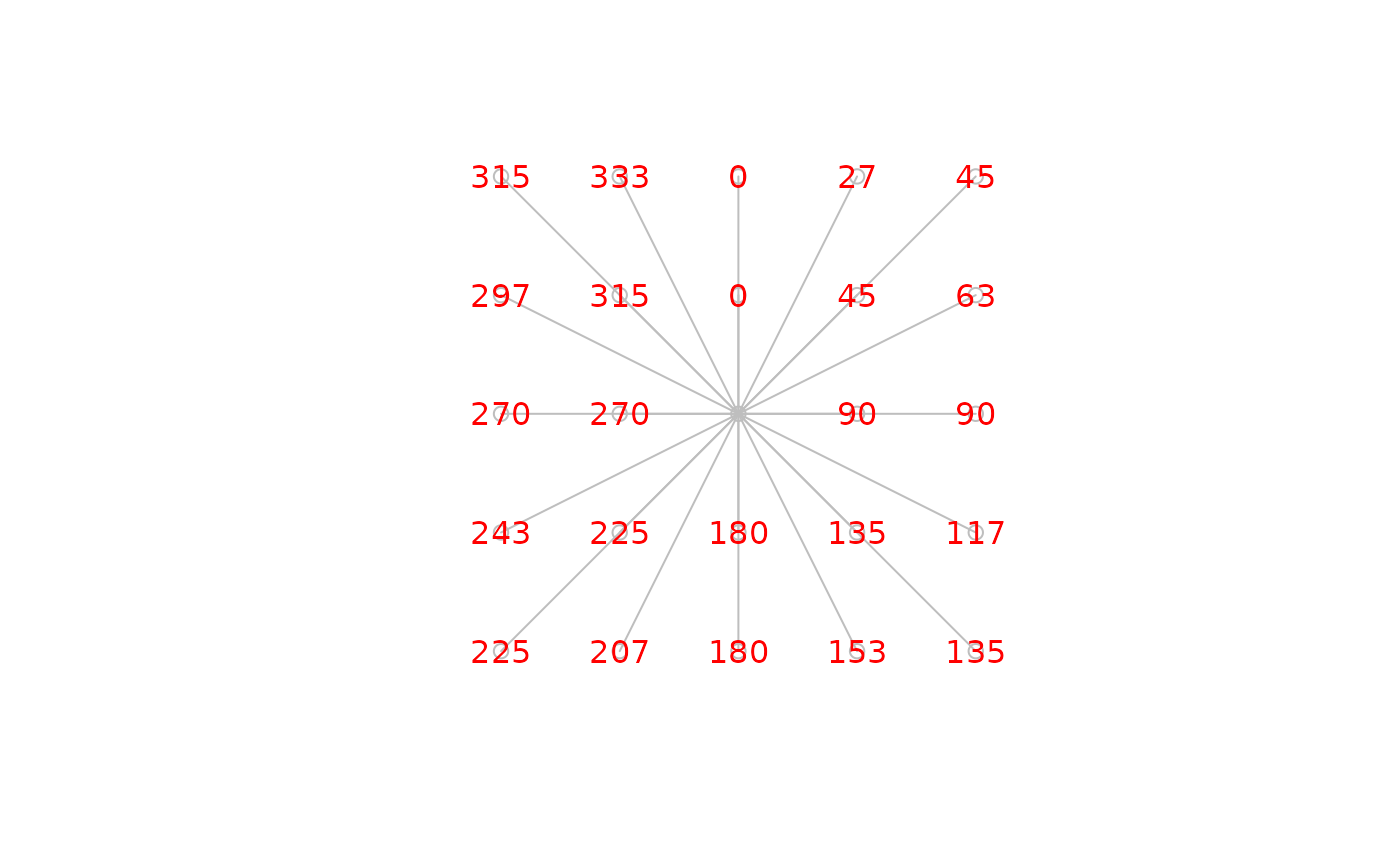
# Center and all other points on a 5*5 grid
library(stars)
#> Loading required package: abind
m = matrix(1, ncol = 5, nrow = 5)
m[(nrow(m)+1)/2, (ncol(m)+1)/2] = 0
s = st_as_stars(m)
s = st_set_dimensions(s, 2, offset = ncol(m), delta = -1)
names(s) = "value"
pnt = st_as_sf(s, as_points = TRUE)
ctr = pnt[pnt$value == 0, ]
az = st_azimuth(ctr, pnt)
plot(st_geometry(pnt), col = NA)
plot(st_connect(ctr, pnt, k = nrow(pnt), progress = FALSE), col = "grey", add = TRUE)
#> projected points
plot(st_geometry(pnt), col = "grey", add = TRUE)
text(st_coordinates(pnt), as.character(round(az)), col = "red")