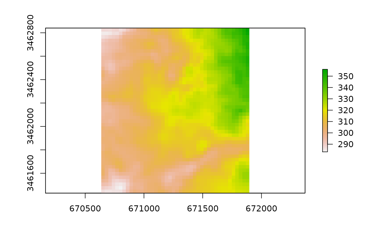
Digital Elevation Model (DEM) of Ramot neighborhood, Beer-Sheva. Raster values represent elevation above sea level, in meters.
beersheva_elev
Format
A RasterLayer representing a grid of 1974 raster cells, each cell is a 30*30 meters rectangle. Data source is the Shuttle Radar Topography Mission (SRTM) 1 Arc-Second Global dataset.
References
https://lta.cr.usgs.gov/SRTM1Arc
Examples
beersheva_elev#> class : RasterLayer #> dimensions : 47, 42, 1974 (nrow, ncol, ncell) #> resolution : 30, 30 (x, y) #> extent : 670636.6, 671896.6, 3461431, 3462841 (xmin, xmax, ymin, ymax) #> crs : +proj=utm +zone=36 +datum=WGS84 +units=m +no_defs #> source : memory #> names : elev_m #> values : 283.2574, 356.0146 (min, max) #>